
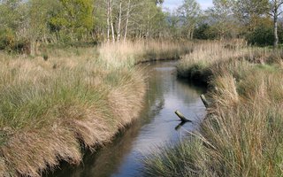
The Lima estuary with wide and flat margins, in a markedly agricultural landscape
The Lima valley in the municipality of Viana do Castelo has wide and flat margins, in a agricultural landscape, with the occasional occurrence of riparian and forests galleries. In the lower zone of the estuary, the river extends and appears in the riverbed, mainly in the middle estuary, due to the deposition of sediments by contact with the saline wedge of marine origin. Despite human occupation throughout its extension, the area further up the estuary has a significant degree of conservation.
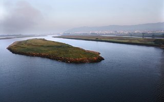
Due to human occupation, the Lima River estuary has been severely modified by anthropic action, namely with regard to the artificial consolidation of margins.
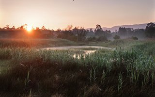
So, the area corresponding to the low estuary, formerly occupied by sands of marine origin and fine sludge, is currently occupied by the commercial port facilities. Despite these changes, there are spaces in the estuary where the typical vegetation of medium and high estuaries is well represented, with a set of estuarine wetlands very interesting at an ecological level, such as Veiga de S. Simão, the lagoons of Vila Franca, the marshland da Meadela and the current Urban Ecological Park of Viana do Castelo (PEUVC) which, although not within the limits of the Special Conservation Zone (SCZ), represents an important biotope in ecological terms.
The Lima River Special Conservation Zone extends over 5382 hectares, of which 1891 hectares (about 35%) are within the boundary of the municipality of Viana do Castelo.
In this SCZ, there occurs 13 biotopes from Annex I of the Habitats Directive, 2 of which are considered priority. The priority habitat formed by groves of white oak (Quercus robur) has little expression, having been almost entirely replaced by eucalyptus forest plantations (Eucalyptus globulus) and maritime pine (Pinus pinaster).
The Lima valley in the municipality of Viana do Castelo has wide and flat margins, in a agricultural landscape, with the occasional occurrence of riparian and forests galleries. In the lower zone of the estuary, the river extends and appears in the riverbed, mainly in the middle estuary, due to the deposition of sediments by contact with the saline wedge of marine origin. Despite human occupation throughout its extension, the area further up the estuary has a significant degree of conservation.
Due to human occupation, the Lima River estuary has been severely modified by anthropic action, namely with regard to the artificial consolidation of margins.
So, the area corresponding to the low estuary, formerly occupied by sands of marine origin and fine sludge, is currently occupied by the commercial port facilities. Despite these changes, there are spaces in the estuary where the typical vegetation of medium and high estuaries is well represented, with a set of estuarine wetlands very interesting at an ecological level, such as Veiga de S. Simão, the lagoons of Vila Franca, the marshland da Meadela and the current Urban Ecological Park of Viana do Castelo (PEUVC) which, although not within the limits of the Special Conservation Zone (SCZ), represents an important biotope in ecological terms.
The Lima River Special Conservation Zone extends over 5382 hectares, of which 1891 hectares (about 35%) are within the boundary of the municipality of Viana do Castelo.
In this SCZ, there occurs 13 biotopes from Annex I of the Habitats Directive, 2 of which are considered priority. The priority habitat formed by groves of white oak (Quercus robur) has little expression, having been almost entirely replaced by eucalyptus forest plantations (Eucalyptus globulus) and maritime pine (Pinus pinaster).

Location
The Lima River SCZ occupies a total area of 5382 hectares, covering the municipalities of Viana do Castelo (1891 ha), Arcos de Valdevez (1291 ha), Ponte da Barca (401 ha), Ponte de Lima (1749 ha) and Vila Verde (26 ha).
Coordinates
Lat: 41.72687829268471
Long: -8.665372035634725
 Theme
Theme
 Point of interest
Discover the Natura 2000 Network
Find Points of Interest at the Lima River SCZ


Hello little one!
I'm Piquinhos and I can help you learn more about the Geopark!

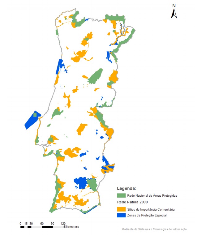
Natura 2000 Network
Natura 2000 Network
The Natura 2000 Network is an ecological network for the European Union community space created with the aim of ensuring the conservation of habitats and biodiversity in the Community territory, through the conservation of biotopes and species. It results from the application of the Birds Directive (79/409 / EEC) and Habitats Directive (92/43 / EEC), having been transposed into Portuguese legislation by DL 49/2005, of 24 February. It constitutes an instrument of territorial management in which the guidelines for territorial management are established in the SCZ and SPA, as well as the measures for the conservation of species and habitats.
It is formed by the following classified areas:
- Special Protection Areas (SPA), established under the Birds Directive, aimed at protecting bird species and their habitats;
- Special Conservation Zones (SCZ), established under the Habitats Directive, created by Member States from Sites of Community Importance (SCI), to which the necessary measures are applied to maintain or restore the favorable conservation status of habitats or of species.
In the area covered by the NATURA 2000 Network, human activities must be compatible with the conservation of habitats and species contained in the Annexes of DL 49/2005, of 24 February, with a view to ecologically sustainable management.
The municipality of Viana do Castelo comprises three natural areas of community importance, classified under the Natura 2000 Network, which occupy 15% of the territory: North Coast SCZ , Lima River SCZ and Serra D’Arga SCZ.
Child Mode
Discover the geopark in a simpler format, aimed at the little ones.
Clique ENTER para pesquisar ou ESC para sair