
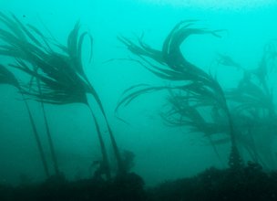
Baixo do Rodanho is located between Praia do Rodanho and Amorosa, about 800 meters from the coast and at depths ranging between 15 (18) meters and 5 (10) meters. It is a space where, during the summer, abundant formations of large brown algae (kelps) dominated by Saccorhiza polyschides (Lightf.) Batt. and Laminaria hyperborea (Gunnerus) Foslie. Although very exposed to the waves during storms, it is an easy and not very deep dive site, which makes it suitable for those divers who do not have much experience. Despite this, even for the most experienced divers it is a pleasant place that will not disappoint.
Baixo do Rodanho is located between Praia do Rodanho and Amorosa, about 800 meters from the coast and at depths ranging between 15 (18) meters and 5 (10) meters. It is a space where, during the summer, abundant formations of large brown algae (kelps) dominated by Saccorhiza polyschides (Lightf.) Batt. and Laminaria hyperborea (Gunnerus) Foslie. Although very exposed to the waves during storms, it is an easy and not very deep dive site, which makes it suitable for those divers who do not have much experience. Despite this, even for the most experienced divers it is a pleasant place that will not disappoint.

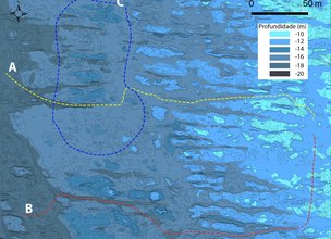
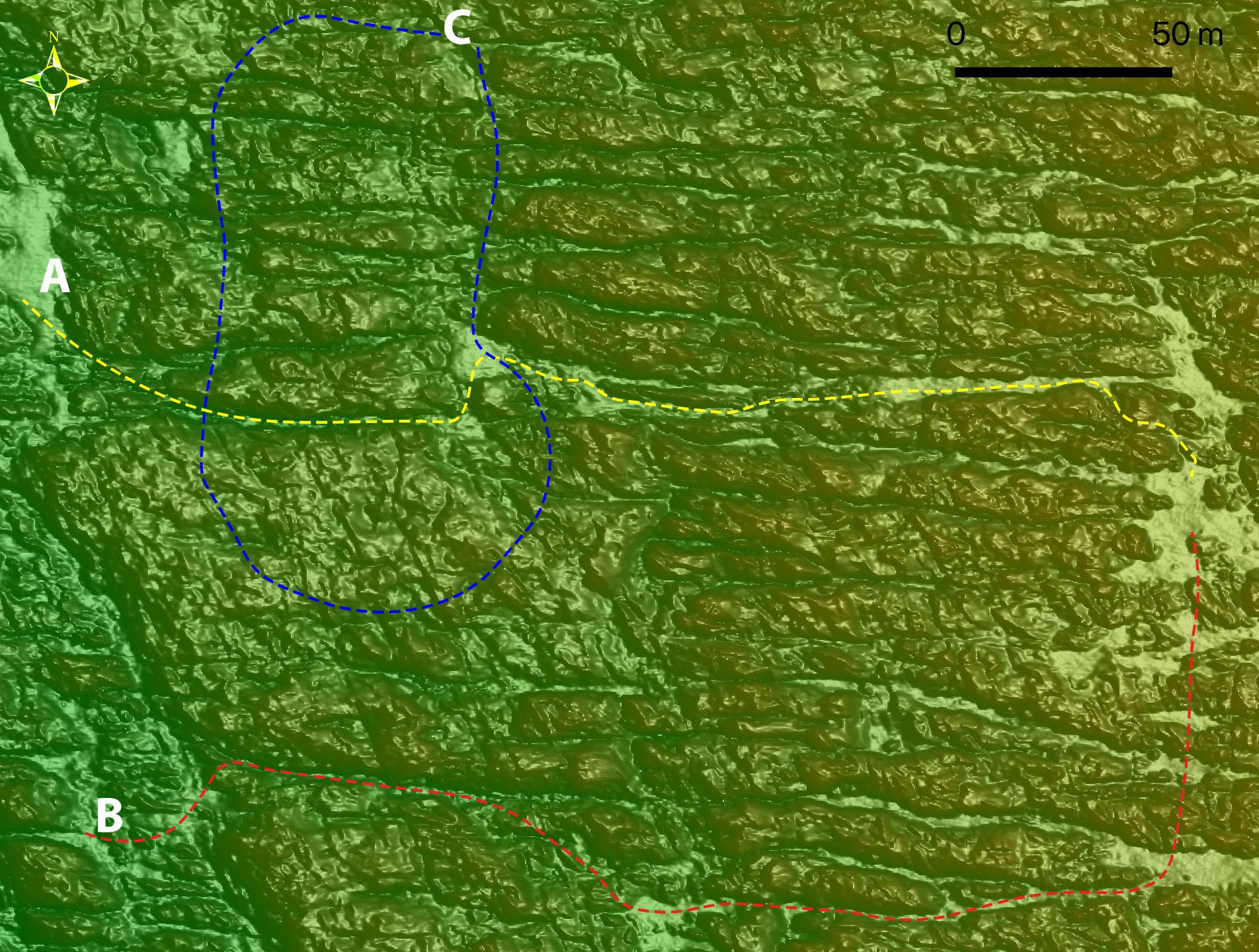
General map of the underwater paths for the dive spot Baixo do Rodanho
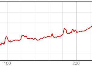
Topographic profile of the A pathway
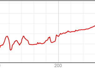
Topographic profile of the A pathway
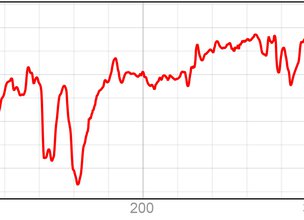
Topographic profile of the C path
Location
Coordinates
Lat: 41.65549172
Long: -8.84169038
 Theme
Theme
 Point of interest

Hello little one!
I'm Piquinhos and I can help you learn more about the Geopark!

Technical details
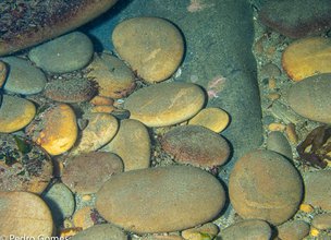
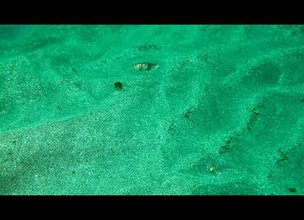
The dive spot down as Baixo do Rodanho is located on a vast rocky platform of a schist nature in which quartzitic outcrops are inserted occasionally, located between Praia do Rodanho and the mouth of the Neiva river. This platform corresponds to a 1st rocky level, with depths between the current sea level and 20 meters deep, in which the sandy sediments are scarce and only appear on the deepest paths or sheltered. With a complex profile, it corresponds to an old space between aged tides between 5 and 10,000 years, when sea level was significantly lower. On the schist walls, the marks of this geological past, making it easy to observe the water circulation channels typical of an area between very exposed tides, giant pans, erosion flaps and pebble deposits rolls of reasonably large individual dimensions (pebbles with 20 cm of major axis). Fossil beds of sea urchins are also observed, in the form of sets of circular cavities that these animals only excavate in a low beach environment.
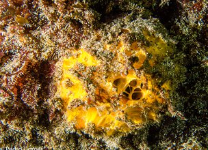
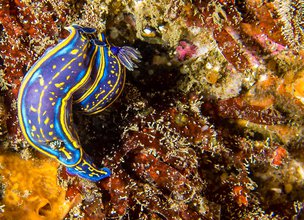
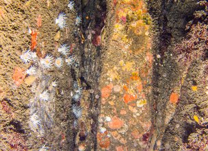
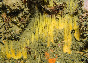
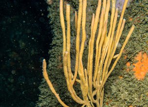
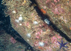
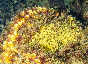
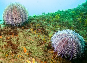
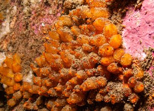
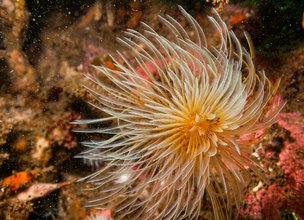
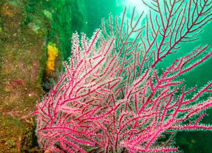
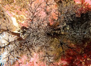
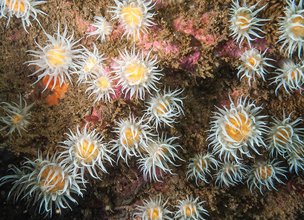
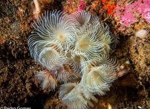
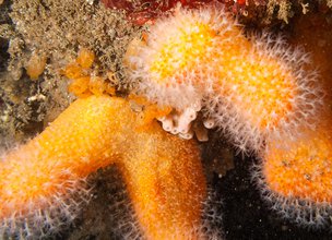
The great topographic heterogeneity creates the ideal conditions for the establishment of very interesting biological communities. In the shallower areas (4-5 meters of depth), macroalgae communities dominate during their time of active growth (late spring to early autumn), in the form of dense forests of kelp (Laminaria sp and Sarchorhiza polyschides). Just below and while the light conditions allow it, fouling algae and small brown algae and red replace the large laminar ones. In the deepest zone or in the most gloomy, where the incoming light is not enough to allow photosynthesis, invertebrates come to dominate, with prevalence for filter species and suspensivorous, such as jewel anemones, sponges and tubular polychaetes. In the most sheltered areas, as a general rule tight cracks and cavities in the rocks, can be found some specimens of gorgonians, such as Leptogorgia lusitanica, an endemism from the Galician and Portuguese waters, and the not so common Eunicella verrucosa.
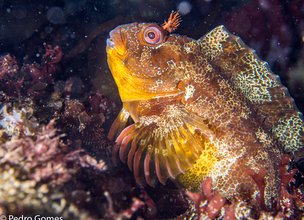
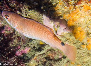
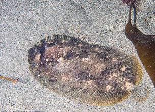
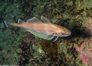
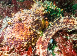
This area is subject to a great deal of fishing effort by traditional and sport fisheries. Whiting-pout, wrasse, octopus, congers, brill, sea bass and seabream are, among others, targets of intense activity that has significant effects on them, either direct (removal by capture) or indirect (accessory destructive effect of the arts used or lost fishing gear). These destructive effects affect not only the target species but also those that have no commercial interest, namely species forming habitat. This is the case of gorgonians, which should form extensive reefs and which have theiR distribution reduced to the few places that, due to the topography, are protected from the presence of networks.
The marked routes allow you to explore this platform a little. Routes A and B, with approximately 400 m of total extension, allow to explore the depth gradient and monitor the alignment of channels with predominant W/E direction. Route C explores has a circular shape and allows exploring the N/S alignment in the transition zone of the platform for a sandy space. It is a deeper dive that allows you to explore more vertical rocky walls that lie below the area where the algae can grow.
General map of the underwater paths for the dive spot Baixo do Rodanho
Topographic profile of the A pathway
Topographic profile of the A pathway
Topographic profile of the C path
Child Mode
Discover the geopark in a simpler format, aimed at the little ones.
Clique ENTER para pesquisar ou ESC para sair