
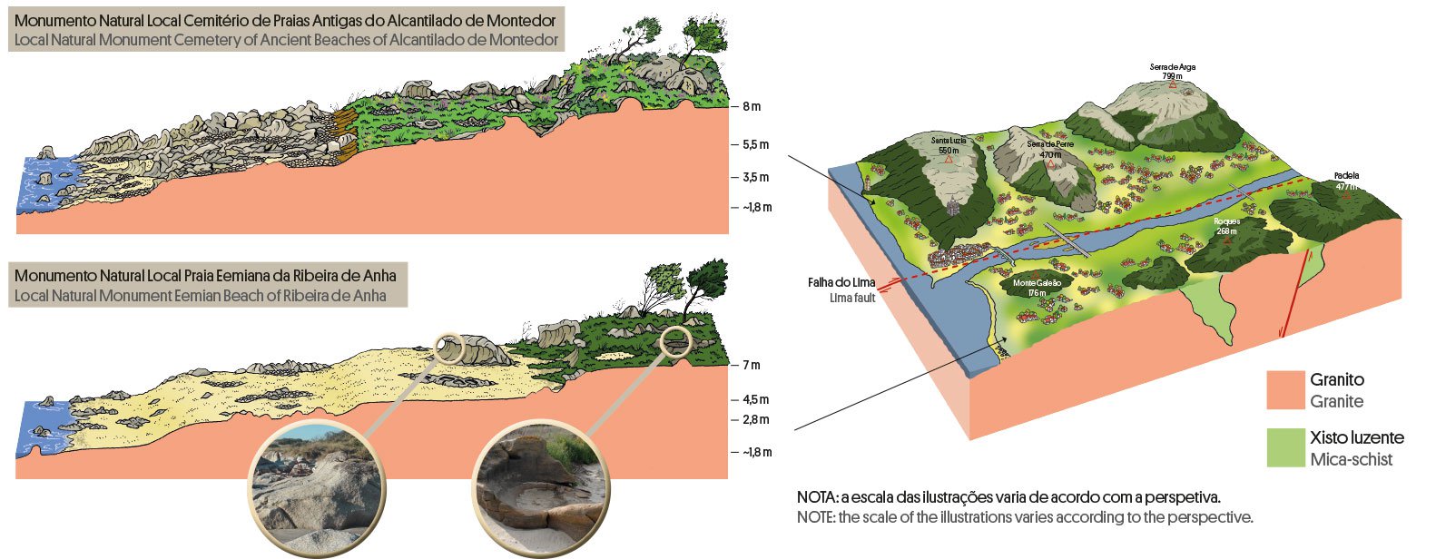
A pebble beach from the last interglacial period (125 thousand years)
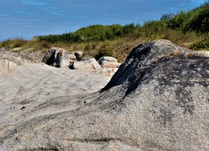
Cabedelo beach, of fine sand, is one of the three coastal sectors where the substrate is granite, being the only one south of the Lima River. The geomorphological cartography of the site marks an area of outcropping granite with gently sloping tops towards the sea and with average altitudes, in general, 100 cm below the corresponding outcrops at Montedor (Local Natural Monument Cemetery of Ancient Beaches of Alcantilado de Montedor).
These sea carved surfaces - coastal platforms - show us that, although the sea constitutes a level surface (although with varying heights over geological time), the records may appear at different heights depending on where they are kept.
The difference in altitude observed on the platforms and considering the sea level of 125,000 years ago (20 cm above the current one) reveals that the northern bank of the Lima River has been raised higher than the southern bank.

Location
Anha
Coordinates
Lat: 41.672611
Long: -8.824713
 Theme
Theme
 Point of interest

Hello little one!
I'm Piquinhos and I can help you learn more about the Geopark!

Technical details
Lima Fault
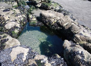
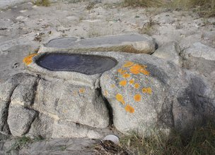
The identification of the staggering of the coastal platforms in Viana do Castelo was carried out by Carvalhido R. (2012) using detailed cartography of the structural alignments and hydrodynamic geoforms, namely potholes and basal notch shapes (sapas or notches). This study allowed to identify 5 levels of preserved rock platforms above the current one (Platform VI): Plat. I (18 m), Plat. II (13 m), Plat. III (8 m), Plat. IV.1 (4.5-5.5 m), Plat. IV.2 (2.0-3.5 m) and Plat. V (0.2-1.7 m) and it was found that the width of the coastal platforms is uneven in the different coastal sectors where they are preserved and that there are variations in relation to the reference altimetric interval values, with a maximum expression of 100 cm between Montedor (LNM Alcantilado de Montedor) and Cabedelo (LNM Ribeira da Anha).
In this LNM two coastal platforms are preserved above the current one and which were interpreted as Eemian levels (MIS5e): Platform IV (3.9-4.5 m, sapa at 4.5 m) and Platform V (2.1-2.8 m). The Forte do Cão Conglomerates and Sands are preserved approximately 100 cm below the same terrace level identified in Gelfa (+2.00) (Caminha municipality). This unit testifies to a high energy beach level, installed during MIS5e and constitutes the only record of this environment known in the municipality of Viana do Castelo. These observations corroborate the effect of regional subsidence of the Lima-south compartment, with reference to the coastal sector of Montedor, which will have suffered vertical deformation at a rate of about 0.008 mm / a above that seen in the south of Lima. This phenomenon was attributed to the inverse component of the probable failures ENE-WSW (Lima and Pêgo), already somewhat out of tune with the current WNW-ESE tension field (Ribeiro et al., 1996), which is why it is very low (in Carvalhido, 2012 )
References and scientific articles
Carvalhido (2012). O Litoral Norte de Portugal (Minho-Neiva): evolução paleoambiental quaternária e proposta de conservação do património geomorfológico. Tese de Doutoramento, Universidade do Minho, 560 p.
Child Mode
Discover the geopark in a simpler format, aimed at the little ones.
Clique ENTER para pesquisar ou ESC para sair