
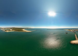
Navigation in the Port of Viana
Sailors land, Viana da Foz do Lima became a village in 1258 by the charter of D. Afonso III, the Bolognese. It is by the sea and to the North Lands that the first tide boats export the salt, produced in the salt pans that can be visited in the Local Natural Monument of Ínsuas do Lima, essential to the conservation of cod.
This is the first economy of the village, being the conditions of exit, reservation and entrance of the ships essential. In the last 400 years there have been countless transformations in the Port of Viana, implying, for example, the removal of rocks, reducing the risk to navigation.
Between 1977 and 1981 the breakwater or north pier was built with 2170 meters and the south pier or spur with 700 meters was built in two phases, the first at the end of the 70s with 400 meters and the second between 1991 and 1992 with 300 meters. This engineering work led to profound changes in alluvial transport, which were essential for the existence of the port area, particularly fishing and commercial ports.
The disturbance of the direction of the predominant swell, from the northwest, in the head of the breakwater, generates a pattern of waves from the southwest to the interior of the mouth of the Lima River, responsible for the creation of Coral beach and the accumulation of sediment in Cabedelo beach.

Location
Darque
Coordinates
Lat: 41.68072
Long: -8.835657
 Theme
Theme
 Point of interest

Hello little one!
I'm Piquinhos and I can help you learn more about the Geopark!

Technical details
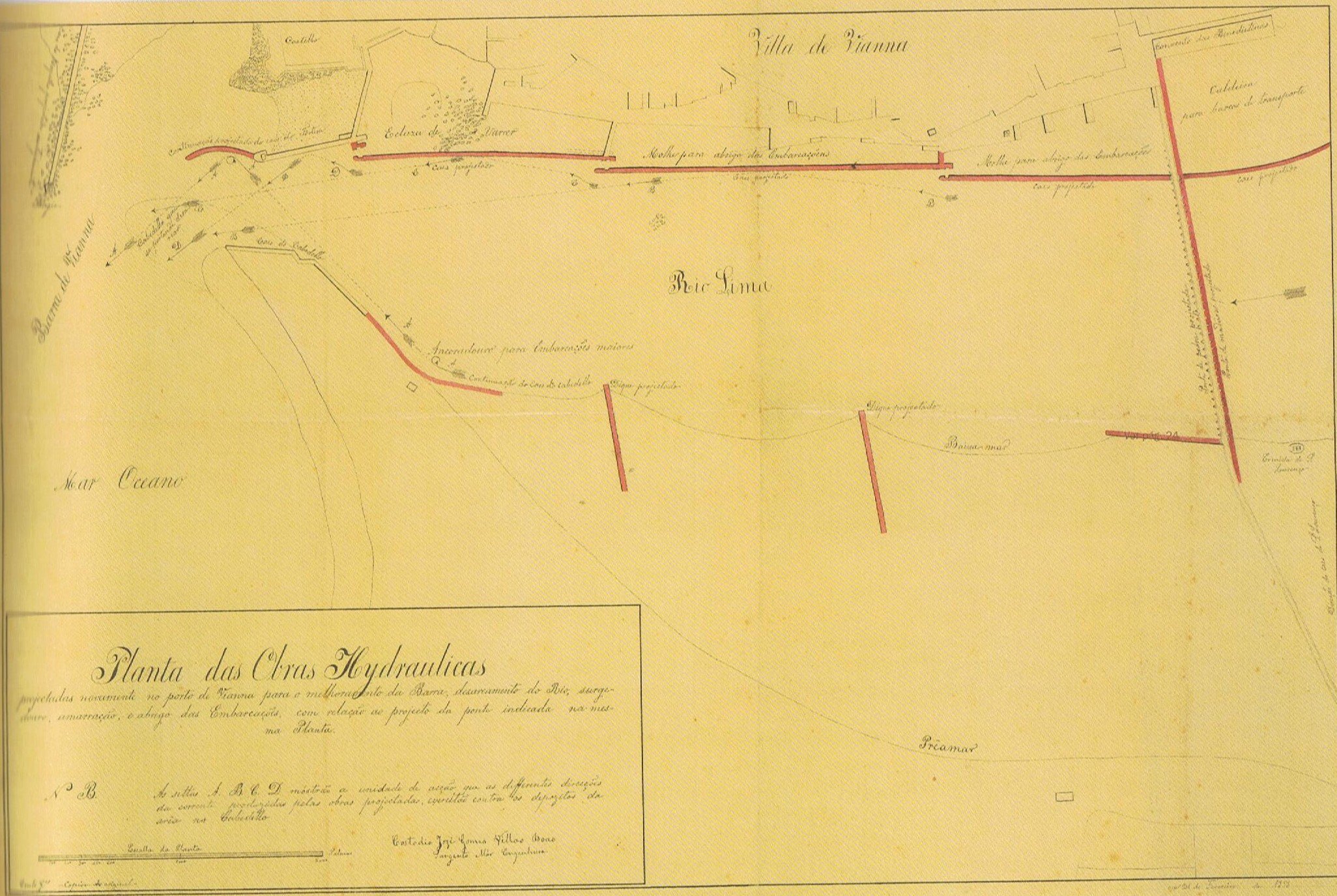
The sea port of Viana
Since medieval times, the vessels that visited the village used to stop at the simple wooden stakes, but with the Portuguese maritime expansion driven by the discoveries, it was necessary to build new structures that would support navigability and trade. Over the past 400 years there have been countless transformations in the Port of Viana with the construction of new docks, tongues, marachões, docks and coastal defense structures.
Between 1977 and 1981 the breakwater or north pier was built with 2170 meters and the spur, built in two phases, the first in the late 70s of the last century with 400 meters and the second between 1991 and 1992 with 300 meters, its total length being 700 meters. These engineering works have led to profound changes in alluvial transport, essential for the existence of the port area, namely the fishing and commercial ports.
Child Mode
Discover the geopark in a simpler format, aimed at the little ones.
Clique ENTER para pesquisar ou ESC para sair