
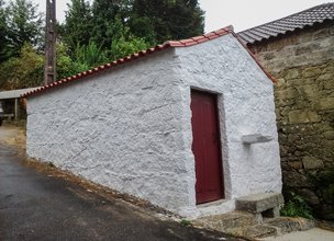
Lands of Geraz trails
Located on the left bank of the Lima River, these lands were gifted by nature, with fertile soils, a mild climate and an abundant biodiversity that allowed human occupation over more than 2,000 years.
The mythical Lugar da Passagem (Passage square) embodies its favorable geostrategic position ensuring, the crossing of the river by many pilgrims and others who were going to sell on the other side of the bank. The monolithic next to the pier with inscriptions of the prices of long ago and the six pirogues of the XII and IX century found in this place, are some evidences of the enormous commercial flow that passed through there until the middle of the 20th century. The monolithic next to the pier with inscriptions of the prices of long ago and the six pirogues of the century. XII and IX found in this place, are some evidences of the enormous commercial flow that passed through there until the middle of the 20th century. This region is an icon of the richness of rural life.
Agriculture remains an activity of excellence and the quality of its products is the most evident proof of its value. The authentic flavor of the cereals and vineyards of the loureiro and vinhão grape varieties preserve ancient knowledge and flavors, perpetuated in the immense built heritage that stands out in the landscape.
Datasheet PR20 - Lands of Geraz Trail
Duration: 2h40m
Distance: 13,1 km
Initial height: 5m
Minimum height: 120m
Maximum height: 5m
Difficulty level: Easy
Category: Circular
Starting point: 41.724253, -8.675728
Informative leaflet: PR 20 - TRILHO TERRAS DE GERAZ
Route in KMZ format for download: KMZ_PR20 TRILHO TERRAS DE GERAZ

Location
União das Freguesias de Geraz do Lima (Santa Maria, Santa Leocádia e Moreira) e Deão
Coordinates
Lat: 41.724494
Long: -8.6754
 Theme
Theme
 Point of interest

Hello little one!
I'm Piquinhos and I can help you learn more about the Geopark!

Technical details
Child Mode
Discover the geopark in a simpler format, aimed at the little ones.
Clique ENTER para pesquisar ou ESC para sair