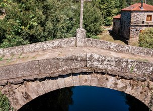
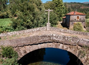
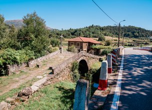
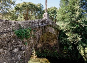
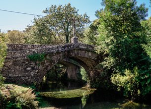
Important Roman roads passed through the territory of Viana do Castelo, such as the famous Per loca marítima, referenced in Antonino's itinerary. This route, leaving Bracara Augusta, passed by Cávado and then Lima, going through the entire Vianense Municipality until Âncora, which was crossed by the Tourim bridge. This bridge, which still has part of its Roman foundations, was rebuilt in medieval times, having been part of one of the most important "paths of Santiago", followed by thousands of pilgrims and essential for the economic development of this region. The current bridge, although maintaining its medieval design, namely the trestle profile, already corresponds to a reconstruction of the Modern Age, possibly between the 17th and 18th centuries.
Important Roman roads passed through the territory of Viana do Castelo, such as the famous Per loca marítima, referenced in Antonino's itinerary. This route, leaving Bracara Augusta, passed by Cávado and then Lima, going through the entire Vianense Municipality until Âncora, which was crossed by the Tourim bridge. This bridge, which still has part of its Roman foundations, was rebuilt in medieval times, having been part of one of the most important "paths of Santiago", followed by thousands of pilgrims and essential for the economic development of this region. The current bridge, although maintaining its medieval design, namely the trestle profile, already corresponds to a reconstruction of the Modern Age, possibly between the 17th and 18th centuries.
Location
Amonde
Coordinates
Lat: 41.7958667
Long: -8.7674861
Hello little one!
I'm Piquinhos and I can help you learn more about the Geopark!
Technical details
Child Mode
Discover the geopark in a simpler format, aimed at the little ones.
Clique ENTER para pesquisar ou ESC para sair
