
Vilar de Murteda trails
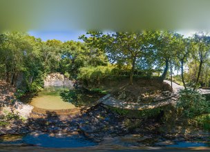
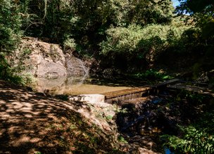
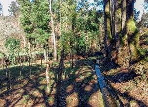
This circular trail starts at the church of Vilar de Murteda, and takes place in the lands of the parish of Vilar de Murteda, standing out for its high landscape, cultural and environmental interest. It has a length of 7.5 km covering the most emblematic places of that parish, such as the Pereiro waterfalls, the extensive "levadas"(irrigation channels), the many cereal watermills and various devices that are found on the Fulão/Seixo river.
Datasheet PR27 - Route of Murta Trail
Duration: 2h00m
Distance: 7,46 km
Difficulty level: Easy
Category: Circular
Starting point: 41.770172, -8.724372
Route in KMZ format for download: KMZ_PR27 TRILHO DA ROTA DA MURTA

Location
União de Freguesias de Nogueira, Meixedo e Vilar de Murteda
Coordinates
Lat: 41.7702
Long: -8.724522
 Theme
Theme
 Point of interest

Hello little one!
I'm Piquinhos and I can help you learn more about the Geopark!

Technical details
Child Mode
Discover the geopark in a simpler format, aimed at the little ones.
Clique ENTER para pesquisar ou ESC para sair